
Nature's Fire Power: When Flames Create Clouds
Okay, I need to tell you about something that sounds like science fiction but actually happened last summer. Wildfires in Europe got so intense that they literally created their own storm systems. I mean, how wild is that?
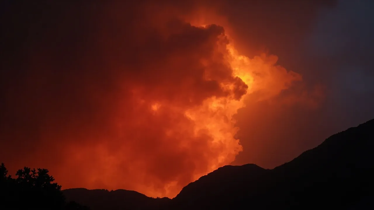
In July 2026, Spain and France faced some of the worst wildfires either country had seen in decades. We're talking massive, devastating blazes that forced hundreds of thousands of people to evacuate their homes. But here's what really blew my mind: in southwestern France, the fires became so powerful that they created something called a pyrocumulonimbus — essentially a thunderstorm cloud born from fire.
The Science Behind the Madness
Let me break this down in simple terms because honestly, the physics here is pretty mind-bending.
A pyrocumulonimbus cloud forms when an intense fire heats the air so dramatically that it rises rapidly, carrying smoke and combustion particles high into the atmosphere. As this hot air column rises, it creates its own weather system — complete with strong winds, lightning, and in some cases, even hail.
Think of it like this: regular thunderstorms form when the sun heats the ground and warm air rises. Well, when you have a wildfire burning at thousands of degrees, you're basically supercharging that process. The fire becomes its own weather engine.
Atmospheric scientists who monitor these rare events say they've seen pyrocumulonimbus clouds occasionally form over Spain and Portugal in recent decades. But the July 2026 event in France? That was a first for the country. Never before had French wildfires produced their own fire clouds.
How Did We Get Here?
Here's what makes this story even more concerning. These mega-fires didn't happen randomly. Scientists with The State of Wildfires Project analyzed the conditions and found a troubling pattern.
First, an unusually wet winter blanketed grasslands, shrublands, and forests with abundant moisture. That sounds good, right? More rain, more vegetation, healthier ecosystems? Well, not exactly.
That winter rain encouraged incredibly dense plant growth across huge areas. Then, repeated heat waves and drought conditions moved in, basically drying out all that lush vegetation like kindling. And when I say "kindling," I mean millions of acres of perfectly dry, highly flammable fuel waiting for a spark.
Strong winds, sometimes reaching 65 kilometers per hour, did the rest. They fanned the flames into infernos that spread across the landscape at terrifying speeds.
The Numbers Are Staggering
In Spain's Ávila province, a single wildfire burned through approximately 50,000 hectares — making it the largest wildfire ever recorded in the country's history. It surpassed a fire from just the previous year, showing how these extremes are becoming the new normal.
In France, more than 90,000 hectares went up in flames by late July, representing the greatest area lost to fire in the country in decades.
Satellite imagery from NASA's Landsat 9 showed the devastation in heartbreaking detail. The images use false colors where healthy vegetation appears light green and burned terrain appears brown. Looking at these photos of areas that were forests and homes just weeks before, you can see how thoroughly these fires reshaped the landscape.
Watching Fire From Space
One silver lining in all this darkness? We now have incredible tools to track these disasters in real time.
NASA's satellite systems, including FIRMS (Fire Information for Resource Management System) and the Worldview browser, allowed scientists and emergency responders to monitor these blazes as they unfolded. Satellites first detected the signs of the Ávila fire near Burgohondo on July 22-23, and by July 24, it had merged with nearby blazes, scorching an area roughly equal to the size of New York City.
This technology won't stop wildfires, but it gives firefighters and communities precious hours to prepare and evacuate.
What Does This Mean For Us?
I don't want to end this on a completely doom-and-gloom note, but I also don't think we should pretend this is normal. Events like the pyrocumulonimbus over France are rare. They're Mother Nature's way of showing us that we've entered uncharted territory.
These aren't just bad fire seasons. They're fundamental changes in how fire behaves on our planet. The same conditions that created these fires — unusual winters, extreme heat, prolonged drought — they're all connected to larger patterns that scientists continue to study.
The good news? Thousands of firefighters and military personnel across both countries worked tirelessly to bring these blazes under control. By late July, evacuation orders began lifting as crews gained the upper hand.
But the warning from forecasters was clear: the danger remains high because hot and dry conditions are expected to continue. And if this summer taught us anything, it's that we should listen when scientists say we're entering a new era of wildfire behavior.
Stay safe out there, friends. And if you're in a fire-prone area, please take precautions seriously. These aren't your grandfather's wildfires anymore.
Source: Science Daily